Versão em Português
Project

Indigenous Territorial Management in the South of Amazonas State

International Institute of Education of Brazil (IEB)

Project official website
Total project value
R$ 11,448,505.00
Total support amount
US$ 3,598,913.90
Contracted

Presentation

Objective

To support: (i) the implementation of Territorial and Environmental Management Plans in the Southern Amazon of Indigenous Lands - IL in the Purus River basin (IL Boca do Acre, IL Apurinã Km 124 BR-317, IL Água Preta / Inari and IL Caititu ) and in the Madeira River basin (IL Jiahui, IL Nove de Janeiro and IL Ipixuna) and; (ii) the development of a Territorial and Environmental Management Plan for the Tenharim Indigenous Land of Igarapé Preto in the Madeira River basin

Beneficiary

2,179 indigenous residents of the eight indigenous lands covered by the project

Territorial scope

Eight Indigenous Lands (IL) in the south of Amazonas, covering 1,095,169 hectares: ILs Boca do Acre, Apurinã Km 124 BR-317, Água Preta / Inari, Caititu, Jiahui, Nove de Janeiro, Ipixuna and Tenharim do Igarapé Preto

Description

CONTEXTUALIZATION

The project aims to contribute to the National Policy on Territorial and Environmental Management in Indigenous Lands - PNGATI, instituted by Decree 7,747, of June 5, 2012, supporting the elaboration and implementation of Territorial and Environmental Management Plans (PGTA) In the Indigenous Lands.

Territorial and Environmental Management Plan (PGTA) is an instrument that represents the planning, agreed by the entire indigenous community involved, of the use of its territory for cultural, environmental and economic purposes. In general, it develops around three main thematic axes - territorial protection, sustainable management and use of natural resources and training - but it should reflect the particularities of each context and the local management strategies of the indigenous territories.

In this context, the project presented by IEB comprises the activities of creating a PGTA of one Indigenous Land (IL) and of implementing a PGTA of the other seven ILs, four in the Purus River basin and three in the Madeira River basin.

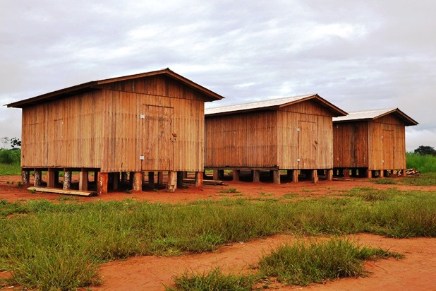
The Southern Amazonas region, where the ILs are located, is among the state's areas with the worst social, economic, institutional and environmental indicators. The region, which borders Acre, Rondônia and Mato Grosso, is characterized by intense deforestation, land conflicts, violence, land grabbing and territorial expropriation of traditional and indigenous populations.

THE PROJECT

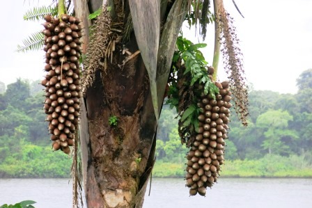
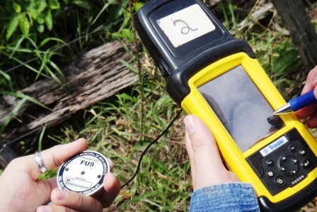
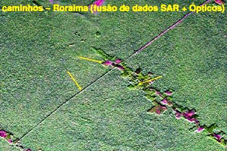
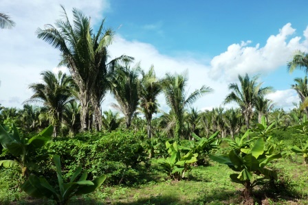
At the ILs of the Purus River basin (IL Boca do Acre, IL Apurinã Km 124 BR-317, IL Água Preta / Inari and IL Caititu) and the Madeira River basin (IL Jiahui, IL Nove de Janeiro and IL Ipixuna), the project supports the implementation of the respective Territorial and Environmental Management Plans (PGTAs), developing actions of i) Strengthening of indigenous associations, with training program for leaderships and improvement of communication and transport infrastructure of associations; ii) Control and Territorial Protection, through the training of indigenous agents in territorial protection and the carrying out of surveillance tours in the ILs; iii) Environmental management, recovery of degraded areas and water resources, including the training of environmental agents, installation and maintenance of forest nurseries, and agroforestry efforts. iv) Management and sustainable use of natural resources, with the elaboration of Agro-extractive Potential Production Diagnostic and market research for this production, as well as the provision of specialized technical assistance and installation of infrastructure for handling indigenous products; v) Monitoring the progress of deforestation in the 7 ILs from the installation of a tool system of Geographic Information Systems in the indigenous associations involved in the project and training of indigenous people to operate them.

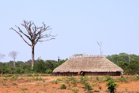
At IL Tenharim do Igarapé Preto, the project supports actions for the preparation of its PGTA, such as awareness building and mobilization, surveys and field research and discussion, elaboration, agreement and delivery of the PGTA.

INTERVENTION LOGIC

The project falls within the "Sustainable Production" (1) and "Land Use Planning" (3) components of the Amazon Fund's Logical Framework.

Click on the following image to view its objectives tree, that is, how the project's outputs are linked to the expected outcomes and impacts.
quadrologico_EN

Evolution

Date of approval 11.01.2016
Date of the contract 12.26.2016
Disbursement period 63 months (from the date the contract was signed)
approval
11.01.2016
award
12.26.2016
conclusion

Disbursement

date amount
1º disbursements 02.14.2017 R$2,297,263.84
2º disbursements 12.22.2017 R$2,258,260.31
3º disbursements 11.28.2018 R$2,206,159.17
4º disbursements 10.25.2019 R$3,577,326.87
5º disbursements 01.13.2022 R$703,785.92
Total amount disbursed R$11,042,796.11

Total amount disbursed in relation to the Amazon Fund’s support

100%

ACTIVITIES CONDUCTED 

In the context of strengthening indigenous associations, seven meetings were held to open the project and update the strategies for implementing the Territorial and Environmental Management Plans (PGTAs) and five meetings to monitor and evaluate the project with indigenous partner associations. The project also supported the participation of 12 indigenous leaders in the XI General Assembly of the Coordination of Indigenous Organizations of the Brazilian Amazon (Coiab).

The third module of continuing education for indigenous managers was carried out, with the main objective of implementing the PNGATI, expanding the knowledge about political and technical management of the associations and offering a training course for the monitoring of deforestation in Indigenous Lands (TIs) through the Georeferenced Information System (SIG). Boats, motors, and various equipment were purchased, such as computers, datashows, speakers, microphones and power generators, as well as motocultivators and brushcutters to support community gardens and family units in the villages served. The project also supported indigenous associations with the installation of the internet.

In the territorial control and protection axis, a total of 20 surveillance tours were carried out, which occur annually in each IT with the participation of indigenous environmental agents and field advisors from the IEB, in synergy with the FUNAI; the construction of a surveillance house and the renovation of the house in the Boca do Acre IT, used by the indigenous people when they go out to hunt and/or fish, as well as to demonstrate the presence of the indigenous people in the territory, removing invaders.

There were also four modules of the continuing education course and the second on environmental management for Indigenous Environmental Agents (AGAMIN), with the participation of 122 indigenous people, trained in the recovery of degraded areas, water resources management and agroforestry systems (SAFs). Two modules of the continuing education course for the Indigenous Environmental Agents (AAIs) of Madeira and Purus river basins were also carried out. In total, 184 AAIs were trained, exceeding the target by 263%.

Within the scope of production support activities, agroforestry efforts were carried out in the Jiahui, Boca do Acre, Caititu, Nove de Janeiro and Ipixuna Indigenous Lands; the mapping and georeferencing of Brazil nut trees in the Nove de Janeiro Indigenous Lands; monitoring of Brazil nut and açaí production in the Diahui and Ipixun Indigenous Lands; support to the crops and flour production in the Nova de Janeiro IT. Six sheds were also built for Brazil nut storage and improved access to Brazil nuts and planning support with Caititu IT Brazil nut trees for Brazil nut cleaning and crop support. Organic fertilization course was offered and handicraft processing kits were purchased for the Apurinã and Boca do Acre ITs. The technical assistance and rural extension (ATER) actions were continued in the seven ITs covered by the project, with 51 visits. It is also worth mentioning the implementation of 31 structures for handicrafts and processing of agroextractivist products.

In the activity of elaborating the PGTA of the Tenharim do Igarapé Preto IT, the third ethnomapping excursion was carried out, with the participation of the indigenous researchers Tenharin, a workshop of participatory writing of the ethnomapping with the community and two workshops of participatory planning and indigenous territorial management, for the agreement of the PGTA. After the territorial management planning stage, the PGTA was completed and will be sent to the Tenharin for remote assessment.


Final Evaluation

Collection

In this area we offer some PDF files with the main publications generated by the project. Click the filename to start the download.