INSTITUTIONAL AND ADMINISTRATIVE ASPECTS
The project’s administrative and financial management was performed by the Muraki Institutional Support Foundation. This support foundation was responsible for managing the project’s resources, as well as for all the purchases and contracts required for its implementation. The Amazonas State University was responsible for the general coordination of the research activities, while the implementation of these activities was in the hands of the 13 research nuclei public connected to the region’s public universities.
The project’s execution required that the research network should involve 234 researchers, including those who received research grants for the project and those who participated voluntarily, interested in the training of the research methodology of the project.
RESULT AND IMPACT INDICATORS
The project’s activities contributed towards the results of the “scientific and technological development” (4) component of the logical framework of the Amazon Fund.
Outcome 4.3: Territorial and protection management instruments implemented for the benefit of communities living in the Amazon biome from the identification and dissemination of indigenous forms of sustainable use of natural resources
- Number of mapping workshops held (output indicator)
There were initially 27 mapping workshops planned, however 30 workshops were held in total. The result of each workshop was the development and publishing of a volume containing the maps built in partnership with the communities, the leaders’ testimonials, survey of the region’s economic activities, photographs, among other contents.
- Number of trained individuals from the traditional communities (output indicator)
1,185 people were given basic training regarding geographical coordinates, environmental legislation and the territorial rights of the traditional peoples and communities. The plan was to train 900 individuals.
- Number of booklets, newsletters produced and books published (output indicator)
In addition to the 30 volumes, based on the fieldwork performed by researchers in direct contact with the 30 mapped communities and other communities in the region, nine newsletters, ten booklets and five synthesis maps were produced, and three books and five documentary videos were published. Some of the topics covered in these publications and videos were:
- deforestation and devastation in Alto Solimões;
- expansion of oil palm plantations in the quilombolas region in Pará;
- resistance and mobilization of the indigenous groups from Baixo Tapajós;
- traditional peoples and communities and their social practices to conserve the Amazon’s natural resources;
- deforestation in southern Amazonas; and (vi) collective identities and social conflicts in the middle and lower Rio Negro.
- Number of participants in the integrating events performed by the research network (output indicator)
Eight hundred people participated in the nine regional meetings, around 360 people were involved in two partial seminars, and 300 people in the general seminar, a total of 1,460 participants in the integrating events. Part of the strategy was also to disseminate the project’s results by promoting the publishing of all the delivered products, such as the volumes, notebooks, reports, books, maps and video documentaries to an audience of more than 7,000 people, in addition to the 57,000 printed copies of the diverse materials.
Among the events to disseminate the results, it is worth highlighting the public hearing held in the Brazilian Commission for the Environment and Sustainable Development of the Chamber of Deputies (lower house of Congress), in 12.17.2015, where a book called O Congresso Nacional e o desmatamento na Amazônia (The National Congress and Deforestation in the Amazon), developed as part of the project, was broadly disseminated.
- Number of structural actions resulting from the social mapping for social and environmental development in the community (impact indicator)
The content presented in the volumes that followed the mapping workshops was used to help create records of 49 community actions to recognize the territorial rights of the traditional peoples and communities covered by the project in the Amazon biome, as well as 70 complaints regarding violations of their territorial and environmental rights.
These actions included the Terras Indígenas do Baixo Tapajós, where the maps produced during the project were used to create a dialogue with the indigenous representatives and the indigenous Brazilian governing body, the Brazilian National Indian Foundation (FUNAI). That was the case with the indigenous ethnic groups in Rio Preto da Eva (AM), in which the territorial mapping resulted in FUNAI being asked to identify the lands as traditionally occupied by these people, an essential step for an indigenous land to be recognized and demarcated.
Considering the actions that resulted from training the traditional peoples and communities and from the social mapping of their territories, we can conclude that the project managed to reach its outcome “territorial and protection management instruments implemented for the benefit of communities living in the Amazon biome from the identification and dissemination of indigenous forms of sustainable use of natural resources” (4.3), in addition to strengthening the region’s scientific and technological research network.
LESSONS LEARNED
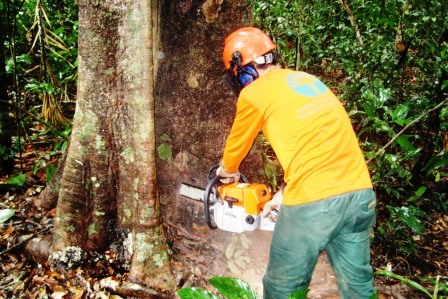
The project highlighted the importance of empowering traditional populations, so that they can fight against deforestation in their territory while allowing the populations directly affected to register its occurrence. If this empowerment expands, then combating deforestation will rely on a larger number of volunteer agents to protect the region’s biodiversity.
The currently rising price of timber and land was also noted, i.e. there is greater criminal attraction to claim land and conduct illegal deforestation. Empowering these traditional populations led to greater resistance against such illegal activities, and in turn there were incidents of intimidation and violence against community leaders and researchers. The commitment of the communities and the project team was necessary to proceed with the field work, which involved submitting complaints to the competent authorities.
In terms of the administrative actions, some of the project’s expenses had to be made in a decentralized manner, because the mapped communities were situated far from the headquarters of the supporting foundation responsible for the project’s financial management. The solution found to give transparency to all paid accounts was presenting the respective account payments at the end of each workshop, with the participation of all those involved.
SUSTAINABILITY OF RESULTS
The main pillar of sustainability regarding the project’s results and impacts relates to the training and empowerment of the people and traditional communities, which enabled them to fight against deforestation. Thanks to the knowledge gained on environmental legislation, land rights, georeferencing and mapping, these populations are now better prepared to defend and preserve the natural resources that are essential to their survival.
The materials produced by the project (volumes, newsletters, booklets, books, maps and video documentaries) were published during the seminars, events and on the internet, which means the results are widely accessible to the general public and constitute a permanent source for consulting. Furthermore, access to the project’s webpage increased from 15,000 hits per month, in 2012, to around 33,000 hits by the end of the project; these hits spread around 110 countries, which highlights the growing interest in its results.
The interest aroused by the project is also evidenced by the number of researchers being invited to perform similar research in Kenya and Central America (Nicaragua and Honduras), as well as the establishment of partnerships with the Kenya Land Alliance and the University of Nairobi, which involve student and researcher exchanges.